What is flood hazard mapping?
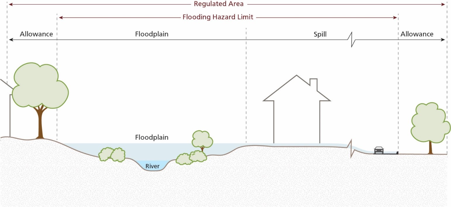
Flood hazard mapping shows the extent of riverine flooding in a given area using computer generated models to predict where riverine flooding will occur. Riverine flooding is when the water level in a river or stream overflows its banks onto neighbouring land. Flood hazard mapping does not create a flooding hazard — it shows where the hazard already exists.

Riverine flood hazards. Diagram by Conservation Halton.
Updated mapping:
- In 2019, Conservation Halton hired a consultant to undertake a study and update flood hazard modelling and mapping for the West Branch of Sixteen Mile Creek. The area of study focused on the existing urban areas in Milton.
- Conservation Halton undertook this comprehensive update to better understand flood hazards using new tools and technologies and to update flood lines and Conservation Halton’s regulatory mapping.
- Conservation Halton is the lead agency, and the Town of Milton participated in the advisory committee to provide technical feedback throughout the study.
-
The updated mapping is currently in the final phase of the study.
Information about the current study and the public engagement opportunities can be found on Conservation Halton’s website.
Flood hazard mapping and property owners:
Flood hazard mapping is used to assess risk and as a decision-making tool for the safe development of land in Milton. Impacted areas may not be suitable for development or may have restrictions.
If your property is located in a flood hazard area, it may be at risk of riverine flooding under an extreme storm event and there may be potential impacts to altering or building on your property. Conservation Halton regulates properties within or close to hazardous lands to ensure risks to any future development from flooding are addressed and that there are no impacts to neighbouring properties.
Provincial legislation enables Conservation Halton’s policies that provide property owners with the opportunity for reasonable home improvements (e.g., minor additions) and replacement of existing structures within or close to hazardous lands
For property-specific information, it is best to always consult with the Town and Conservation Halton before submitting your application.
Roles in flooding mitigation
Below are the different roles that organizations play in flood mitigation.
Municipality (e.g., Town of Milton) |
|
Regional municipality (e.g., Halton Region) |
|
Conservation authority (e.g., Conservation Halton) |
|
Residents (e.g., Milton residents) |
|
Contact Us


